About this blog

The journey from John o'Groats to Land's End took place in 14 sections, starting in 1996 (a week or so each year). The idea came to me in 1995 and I completed the British JoGLE Watershed in June 2009.

I was joined by a number of relations and friends from time to time. Most notable among my walking companions were my son Tim (7 sections) and nephews Peter and Jonny.

After walking the first section in 1996 I discovered that Dave Hewitt had already pioneered the Scottish Watershed (to Cape Wrath) in 1987, and had published his excellent account Walking the Watershed in 1994. We have been in touch since then, and he has been a great encouragement.

A simple definition of the watershed is that any rain falling to the left of the path finishes in the North Sea or English Channel, and anything to the right flows into the Atlantic Ocean, the Irish Sea or the Bristol Channel.

I believe that this was the first walk along the full length of the British JoGLE Watershed. I became aware just after I completed the journey that the late Mike Allen walked a slightly different version (from Land's End to Cape Wrath) between 1988 and 1994, so he will have covered the same ground apart from the most north-easterly 220km.

There have subsequently been several walks and publications about parts of the JoGLE watershed, including Peter Wright's 2010 Ribbon of Wildness account of his Scottish section walked in 2005, which has brought the subject of watershed walking in the UK to a wider audience.

I hope you enjoy this blog. I published a full account in 2025 under the title Walking the British Watershed: John o'Groats to Land's End without crossing flowing water. A summary of the walk also appeared in The Angry Corrie volume 76 in 2009.

Malcolm Wylie.

Monday, 19 September 2005

SECTION 9 - Longbridge to Daventry

I walked this Section solo in September 2005.

One of its most remarkable features was that it took me almost entirely ENE - directly away from my destination at Land's End. The Watershed needed to round the source of the Avon, which was near the end of the Section (see photo).

Tuesday, 27 July 2004

Day 85 - Frankley, Windmill and Lickey Hills


After 2km along the Dudley Canal below Mucklow Hill, the watershed follows a minor road to Lapal, where it crosses the M5. South of Woodgate I had a minor celebration when I was told I could exceed 30mph again.

There followed quite a surprising and pleasant series of minor hills, Frankley (with its beech copse at the summit), Windmill in the Waseley Country Park, and along the North Worcs Path to Beacon Hill in the Lickeys (see photo) - around the edge of a golf course. I enjoyed good views of the Malverns.

This Section ended on the B4096 at 995758. I then walked down to Longbridge station, passing the large Rover MG car plant.

The stats for this Section were 186km with 1161m of ascent (i.e. fairly flat!).

Monday, 26 July 2004

Day 84 - Wolverhampton and the Black Country

Not the most picturesque of days, as I spent most of it in the West Midland conurbation. I calculated that I was restricted to 30mph for almost exactly 24 hours (from about 11am today to 11am tomorrow).

There was the usual mixture of country lanes and footpaths for the first couple of hours. The main points of interest were crossing the M54, and walking "County Lane" for 3km - along the Shropshire/Staffordshire boundary.

Then I passed the Welcome to Wolverhampton sign (onto map 139), and it was largely a matter of getting the job done. It was notable how the quality of the housing started very high on the outskirts and gradually deteriorated as I moved towards the centre of the city. Not knowing it at all well, I was interested to see that the centre is on a hill, and that the Watershed goes right though it. The photo was taken by a local lager-drinker - hence the eccentric composition of the photo.

The Watershed then goes south to Sedgley and SW to Dudley and Sandwell. Just because it was there, I decided to have a bit of fun by walking through Netherton Tunnel (2.7km dead straight and very dark). The book will say a lot more about this.

I camped with permission in the beer garden of the Lighthouse pub between Blackheath and Halesowen (at 969854).

Sunday, 25 July 2004

Day 83 - worship, hospitality and Roman roads

I was up early, in order to get to Gnosall in time for the Sunday service. The morning's walk was an excellent mixture of country lane, footpath and tow-path (along the Shropshire Union Canal - see photo).

I was challenged by a farmer, who reminded me that a farm track being marked on the map doesn't constitute a right of way. Apparently this time I was on land owned by the Queen's cousin Lord Lichfield. He let me through, however.

I got to the church in Gnosall a bit late, and very sweaty, but was made very welcome. One couple even invited me back to their home in Eccleshall for lunch, which by mutual agreement included me having a shower! After lunch Adam gave me lift back to the Watershed.

The afternoon was all minor roads and a string of B villages (Beffcote, Brineton, Blymhill, Bishop's Wood). There was a short stretch of Roman road marked on the map (813180 to 822171) but to follow it I walked though head-high maize, standing corn and lines of straw awaiting the bailer.

I camped near Bishop's Wood having got rather reluctant permission from a farmer - at 829090.

Saturday, 24 July 2004

Day 82 - Millionaires' Row and farms

This was a pleasant day, with some excellent footpaths through the farmland of Staffordshire, and some mostly deserted country roads.

The route took in Baldwin's Gate (via a row of fabulous houses) - onto map127, Maer (where I met a couple walking to their wedding, in full regalia), Ashley, Bishop's Wood (the wood, not the village), Bishop's Offley, and Whitley Heath.

The Wrekin (407m) was visible in the distance to the west.

Harvest was in full swing, and I asked a farmer if I could camp in the corner of his field (see photo) - at 807253. I walked into nearby Woodseaves for a pub supper.

Friday, 23 July 2004

Day 81 - around the Trent and Stoke

It was difficult to get away from the lady of the house (dressed in shocking pink) whose paddock I'd camped in - the pub locals had warned me that she was a talker.

This was a sunny, shorts day, and there was a fair amount of road walking through Biddulph, Kidsgrove and skirting to the west of Stoke-on-Trent and Newcastle -under-Lyme. However, I chose footpaths wherever the Watershed allowed, so by the end of the day I'd enjoyed reasonable variety.

One highlight was Mow Cop (see photo), the most south-westerly grtistone outcrop of the Pennine range, and considered by many to mark its geological terminus. Just before lunch near Talke Pits, I crossed the Trent and Mersey Canal and the railway line where they run through the Harecastle Tunnels. The ventilation shaft chimneys marked their route.

Just after walking past some Keele University halls of residence (completely deserted - I initially though it must be a prison!), I reached the M6 at Keele Service Station. I camped with permission in a fairly wild garden nearby (at 806439).

During supper at the service station I watched the news that Mostar Bidge (destroyed during the Balkan wars in 1993) had just reopened, amidst scenes of great jubilation.

Thursday, 22 July 2004

Day 80 - the Roaches and a couple of jungles

After about 6km south along the A53 Roman road, I headed west along footpaths and some tussocky open land and climbed up to the very impressive Roaches ridge (shown in the photo) -more than 2km of gritstone, very popular with climbers.

The Watershed goes NNW along this ridge, and then goes W on paths until Turner's Pool, a small fishing lake. I found that the easier path crossed a blue line outflow which was visibly trickling, so I spent a ridiculous and intrepid half-hour hopping, hacking and limbo-dancing through the jungle swamp at its east end. I got some very strange looks from the anglers as I went into it and then emerged looking as though I'd been dragged through a hedge backwards - a pretty accurate description.

After lunching by the pool, the afternoon was a mixture of paths, roads, a trespass-with-permission through the Scout camp-site in Barnswood, passing the north end of Rudyard Reservoir (where it's tricky to spot on the map which end was right for the Watershed), then up onto the Hollands ridge. I camped in someone's paddock (916587) and supped frugally at the Fox and Hounds in Biddulph Moor.

Wednesday, 21 July 2004

Day 79 - Axe Edge Moor

Tim and I had just spent a glorious few days in Knoydart, and he dropped me near where I had left the Watershed last year above Buxton. I found the exact spot, to ensure continuity, and then set out at about 3pm.

The route took me up to Axe Edge Moor (summit 551m), with a clear sight of the Cat and Fiddle on the horizon to the west. It's reputed to be the 2nd highest pub in England. The Watershed then joins the A53 (a Roman road) for several km south.

I stopped for supper at the Traveller's Rest just below Oliver Hill, and camped right on its summit (see photo) at 026675.

SECTION 8 - Buxton to Longbridge

This was another solo Section, and it took in the biggest conurbation on the Watershed - Birmingham and its neighbours.

As I was leaving the wilder moorlands of the Pennines, I'd decided to travel lighter this year, and depend on more frequent refuelling stops. So there was no Trangier meths stove, and less food to carry at any one time.

On a biographical note, I'd recently left regularly paid employment with a local authority (on my 55th birthday), and was thinking about starting a small consultancy operation. This did work out in practice, and it ran from 2004 to 2012.

Sadly, I had lost my mother in June - a very faithful encourager of my Watershed venture.

Sunday, 29 June 2003

Day 78 - Jacob's Ladder to Buxton

After church and lunch in Edale, I climbed back up Jacob's Ladder and resumed this final part of Section 7 at about 1pm.

It was a glorious hot, sunny day to finish on. The walking was mostly on paths and uneventful. The most interesting things were a crowd of paragliders on Colborne Edge and Mam Tor, a crowd of frisky bovine teenagers who mock-chased me, and (onto map 119) the final heather-clad ridge of Black Edge.

The last 3km was over very rough ground - deep heather and tussocks - and I left the Watershed at 042756 to make my way down to Buxton. The plan for the following few days was to travel back to Scotland for some real hill-walking with Tim (the Grey Corries from the Ossian station).

The stats for this Section were 170km and 2,122m of ascent.

Saturday, 28 June 2003

Day 77 - kindergarten (kinda') on Kinder

After yesterday afternoon's vicissitudes, today's walk was a relative "walk in the park" (the Peak District National Park).

We drove up to Snake Pass and left the camper van. The Pennine Way is very easy walking from there across to Mill Hill, and we then climbed up onto the plateau. We had lunch at the top of the path (the photo shows Karen feeding Rufus, who was wearing the WWW t-shirt for which he had just qualified!). Afterwards they retraced their steps, and I continued along the path as far as Kinder Downfall.

There was a discernible trickle of water in the stream (which is marked on the map), so I had to take the rough route to Crowden Head and then back to Noe Stool. I left the Watershed at the head of Jacob's Ladder (081861), and dropped down to spend the night in Edale.

Friday, 27 June 2003

Day 76 - low and bleak on Bleaklow

This was a day of two halves, chiefly because the weather in the afternoon was really grim.

The morning was pleasant enough as I followed the Watershed mostly along boundary fences with reasonable tracks alongside. For 200m it coincided with the Trans Pennine Trail, which I hadn't come across before. It gave me pleasure to see from the trail-side plaque that its termini are Liverpool and Hull - where Tim and Emma respectively had gone to university.

I lunched at the dip before Bleaklow Stones, and the heavens opened. The afternoon was spent slithering around in deep peat groughs and zero visibility (see photo) and I got so disoriented that I could hardly remember my east from my west. I took several tumbles, one of which bent my stick irrecoverably. I understood why this is the most popular place for walkers of the Pennine Way to abandon the trip!

At last I made it down to the A57 at Snake Pass (088929) at 4pm.

I'd arranged to meet up with my younger daughter Karen with her husband and 3 month old son Rufus in a nearby caravan club site for the night, so I walked down into Glossop and spent a pleasant evening with them in Hayfield.

Thursday, 26 June 2003

Day 75 - Pennine Way and M62

Today's walk, in fine weather, more or less followed the Pennine Way until its surprising detour round Wessendon Moor.

I had a double disappointment with pubs (the A58 White Horse wasn't open for a second breakfast and the A62 Jolly Roger had recently gone out of business), but this was more than made up for when I hitched down from Standedge for lunch at The Commercial in Uppermill - and caught the bus back up afterwards.

Notable along the way in the morning were the Roman Road just below the Aiggin Stone (see photo), crossing the M62 on the purpose-built and impressive footbridge, and a hilarious boggy little manoeuvre off the PW to avoid a thin blue line - in full view of a bemused couple of more conventional walkers (just before moving onto map 110).

After lunch I took the correct route between two neighbouring reservoirs (Swellands and Black Moss) and then left the PW to hack straight across Wessendon Moor. There was a good path up to Black Hill (582m), the highest point of the day, where the Watershed paradoxically crosses the PW at right angles. Then some more difficult walking until I pitched camp at the head of Stable Clough (104029). I then walked up onto the ridge to get a mobile signal and phoned Chris wish her a happy 42nd wedding anniversary.

Wednesday, 25 June 2003

Day 74 - cider on the Burnley Way

Today's route snaked its way between some large towns (Burnley, Bacup and Littleborough to the right, and Hebden Bridge and Todmorden to the left), but high enough to feel I was in the countryside.

After a pleasant walk along Black Hameldon, the Watershed drops down to the ancient route The Long Causeway which now runs alongside the Coal Clough Wind Farm (which I actually found quite nice to walk past). I was amused to see the sign by the stile saying "single file please" (see photo) - difficult to imagine two people doing it at the same time.

I was given a lift by farmer James down the A646 and back again to do some essential shopping, and then there was a stiff climb up Thieveley Scout and Pike on the Burnley Way. The sun was out, and I enjoyed a cider-facilitated snooze after lunch.

I continued on paths including the Rossendale Way onto map 109, and came down to Calderbrook at 7pm. I had an unsatisfactory meal at a too-posh pub, feeling out of place - too smelly and dishevelled - and then over the Rochdale Canal and up to camp just below the Light Hazzles Reservoir at 960200.

Tuesday, 24 June 2003

Day 73 - Bronte country

The sun streamed into the tent when I got up at 7am - definitely a shorts day. A man walking his dog on the rec didn't seem fazed by my camping there, and we had a good chat. He was well aware of the village's position on the Watershed - they get their water from one side, and send their sewage to the other!

Pleasant footpaths took me over Kelbrook Moor and I then made a schoolboy map-reading error which sent me in a full circle and wasted an hour. Lunch at the Hare and Hounds cheered me up, and after some rather fiddly footpaths I crossed the A6068 and was on the open moor again. There was a long haul through thick bracken onto Ickornshaw Moor.

When I got down to the Bronte Way road (within just a few km of the famous Withins ruin) I was challenged by an estate worker. He said I shouldn't be walking on the moor in the nesting season, but I was allowed to continue once he'd phoned his boss with my explanation of the Watershed venture. There was thick heather on the way up Crow Hill, but the place was completely deserted and it was wonderful to strip off for lunch. Jackson's Ridge to Dove Stones (see photo) was much easier.

After crossing the minor road above Widdop Reservoir, I camped on the open heathland at 916323, with the lights of Nelson and Burnley twinkling below me to the west.

Monday, 23 June 2003

Day 72 - where did the Pennines go?

This was a long day, and I was able to cover 35km because there was very little climbing involved. Once over Rye Loaf Hill (547m), I gradually dropped down to about 200m and stayed there for most of the day.

The initial walking was quite rough, but from High Langber onwards it was very easy - a combination mostly of footpaths, farm tracks and roads. I crossed the railway line and A65 near Hellifield, and reached the Leeds and Liverpool Canal (see photo) at 897493. I followed the canal along its highest section and lunched at Greenber's Lock Stop.

The Watershed follows the Pendle Way through Barnoldswick, and then heads up White Moor. I walked down into the village of Foulridge (actually not foul at all) on minor roads, and after a pub supper I camped on the football pitch (with the encouragement of the locals) at 893425.

Sunday, 22 June 2003

Day 71 - limestone country

This first day was very short - just 7:30pm to 9pm.

I walked from Capon Hall south to Kirkby Fell, with its good views of the limestone scars. The photo shows Great Scar to the west.

I camped by a small pool at 870639 on map 98.

SECTION 7 - Settle to Buxton


This Section covered the southern half of the Pennines.

I walked it solo in June 2003 (as blogged), following on from the northern Pennines in 2002. Tim had work commitments, and the walking was less interesting than further north.

I took the train to Settle and walked up to the Watershed at Capon Hall - finding the small stone which Tim had placed in the wall at the end of Section 6.

On a biographical note, I had become a grandfather in March - and was thrilled that Rufus would be joining me on this Section ( see later).


Thursday, 11 July 2002

Day 70 - Pen-y-ghent and Fountains Fell

Soon after setting off towards Foxup Moor it started raining hard, and we were in cloud. The weather and bog led Tim to describe the walk as "irredeemable".

However, we found ourselves above the cloud as we neared the top of Pen-y-ghent (shown in retrospect in the photo). We rejoined the PW down P-y-G, and passed the large sink-hole (characteristic of limestone country) of Churn Milk Hole - where I saw my first Ring Ousel.

Fountains Fell came next, and it was easy to see how it got its name; there were springs everywhere, and rivulets disappearing into the ground.

We left the Watershed at about 2pm at Capon Hall (866666 - what a lot of 6s), and walked and hitched down to Settle station for the train home.

The stats for Section 6 were 222km and 3,655m ascent. The distance was on a par with earlier sections, but the climbing was significantly less, as expected.

Wednesday, 10 July 2002

Day 69 - Pennine Way the wrong way

This day had a bit of everything.

The first part was along a wall marking the Cumbria/North Yorkshire boundary, with a good quad bike track alongside - down to Garsdale Head with its impressive railway viaduct.

A stiff climb up to Garsdale Common was followed by very tricky terrain across the well-named Shaking Moss - a veritable mire. After lunch by Widdale Great Tarn and an ascent of Great Knoutberry Hill, we crossed the B6255 at the triple head of Widdale (NE), Ribblesdale (S) and Dentdale (NW).

Once up on Grove Head we were in a land dominated by limestone. Between 824832 and 829834 we made the discovery that we were simultaneously following the JoGLE Watershed N-S  and the Pennine Way S-N (see photo). Strange but true. We dropped down Oughtershaw Side, and had cooked supper at the point where we crossed the Dales Way.

After climbing up the other side, Cam Rakes, we found our way through 4km of forest, and then camped on High Green Field Knott at 834780.

Tuesday, 9 July 2002

Day 68 - meeting Wainwright at Nine Standards Rigg

As we were getting breakfast in the morning, a shepherd took us to task for camping on private land without permission. He was unimpressed by our defence that the Watershed had required it, but let us off with a warning.

The morning was slow going across Causey Moss, and then it rained quite hard for a few hours. The Watershed turned SW just after the innominate trig point, and we made our way up Brownber Edge and then up to Nine Standards Rigg - whose distinctive cairns had been clearly visible on the horizon from our camp site.

This is a significant place, as the Watershed crosses Wainwright's coast-to-coast here - in fact they coincide for 1km, horribly eroded. We then struck off to the right, and went up to High Seat, quite close to the young Eden River.

Onto map 98. We made our way south to Ure Head, and had to navigate carefully on the way down between the Eden and the Ure tributaries. After a long descent we reached the B6259 at the head of the Eden valley. We knocked at the nearest cottage to find out about where to buy food, and finished up buying from them - a wonderful mixture including home-made rhubarb pie! We scrambled up the other side and camped on the fells at 770955.

Monday, 8 July 2002

Day 67 - over the A66

After a wet and windy night, we continued along the footpaths recommended by the military - dropping down into the pretty valley below Hilton Fell, then left up Swindale Edge. At the top, we were screeched at by a raptor (probably a Peregrine) defending its nest.

Having skirted Warcop Fell on the path, we were out of the firing range at 830198, and back onto the Watershed proper.

The afternoon was hard going across the bogs of Stainmore Common to the summit of Great Knipe. We found a grouse-shooters hut conveniently open, and sheltered there while we cooked an early supper.

We dropped down to the well-concealed A66 via Beldoo Moss, and camped near a radio mast at 875117.

Sunday, 7 July 2002

Day 66 - discretion or valour?

We had a relaxing morning in Dufton, enjoying a leisurely breakfast at the YH, Sunday papers, a great service at the Methodist Chapel, and an outstanding lunch at the Stag Inn.

We were back on the Watershed at 3:30pm, and continued along the ridge to High Cup Nick (see photo, which doesn't do it justice).

We then encountered the MOD Danger Area - the  enormous firing range under the control of Warcop Barracks. I'd corresponded with the camp commander in advance, and although there are days when firing is suspended (this was one of them), he strongly advised against taking the Watershed across the fells. "There's 30 years of unexploded ordnance up there!". However, we should be OK if we stuck to the footpaths - which we did. This entailed breaking our thin-blue-line rule a couple of times over small streams - but at least we lived to tell the tale. The paths followed Maize Beck and Swarth Beck, and then we camped at 773253.


Saturday, 6 July 2002

Day 65 - springs on Cross Fell

This was just as pleasant as yesterday's walk, except that my feet and Tim's shoulder were causing concern. We made an early start, in order to get down to Dufton YH for the night - our planned half-day of rest.

We made steady progress to the summit of Cross Fell (at 893m the highest point on the English part of the JoGLE Watershed), where we met a mountain biker who took this photo. We passed a number of springs around the summit, feeding respectively the Tyne and the Tees.

At this point the Watershed coincides with the Pennine Way for the first time - for about 5km along the ridge. We dropped off at about 725281 to take the miners' track to Dufton for the night.

Friday, 5 July 2002

Day 64 - heavenly Eden

My journal said "best day yet, by far" on this Section. The weather was perfect and we were back onto real hills. The contours were more gentle than even the Southern Uplands and the ground was generally easy underfoot, which made for fast progress.

The best views were to the west, across the Eden valley to the Solway Firth and the Lake District. The curlews had been replaced by golden plovers, always solitary, with their plaintiff piping.

After lunch below Butt Hill, the terrain became more challenging, but not hard. We reached the Hartside Cafe on the A686 (which claims the best view in England) just after it had closed at 6pm which was a pity. We went on over Fiends Fell, and found an ideal camping spot (just onto map 91, at 645398) - flat and grassy, with a little grotto supplying dripping water.

Thursday, 4 July 2002

Day 63 - Hadrian's Wall and curlews

This was another dry day, and a lot more interesting. We walked across Thirlwall Common and then followed a farm track which eventually led us into the village of Gilsland. We shopped, lunched at Samson Inn, and watched Tim Henman losing a set at Wimbledon.

We crossed the railway line, Hadrian's Wall (not all that impressive at this point - see photo) and the A69 in fairly quick succession, and were looking forward to getting up onto the Pennines proper. Before getting there, we had to negotiate 4km of forest on Denton Fell, a working quarry (which we trespassed across as everyone had gone home for the evening) and the village of Hallbankgate.

Then we were on our way up again. We camped at 581566 below Brown Fell. Curlews had been calling all day, and as we ate our supper we had the new treat of witnessing one of them doing a "drumming" display.

[Footnote, this is the first photo in the blog in which the blue "Wylies' Watershed Way" sweatshirt makes an appearance. I'd commissioned 20 of these from a local firm, to give to whichever of my relations joined me on part of the Watershed. The design shows the map of the route and the planned dates - 1996-2009. The photo at the top of the blog was taken at Land's End at the completion of the walk, by which time 19 of the 20 had been awarded and were being proudly worn.]

Wednesday, 3 July 2002

Day 62 - Wark Forest and midge hell

This was the most forest-bound day on the entire Watershed, with only 2km clear of trees. The forest was a mixture of established, recently felled and newly-replanted trees. Each type posed their own problems for walkers (including my getting severely stabbed in the shin).

I'd cheered up a bit, and the weather was dry. Tim and "Madge" did a great job with the navigation, and we made good progress, particularly on the rare occasions when the thin blue lines allowed us to use the forest roads. We spent several minutes watching a tree-felling machine in action - very fast and efficient - from a distance it almost seemed more like an animal than a machine.

We were so relieved to get out of the forest at the end of the day that we didn't think hard enough about where to pitch the tent. The result was the worst midge storm in history; at least I had a midge hat, but I could hardly see a thing as I was putting the tent up (at 701717). So many of the blighters got into the tent with me, that when the midge net was up and they congregated on its inside, they appeared like a heaving liquid mass - more like oil than animals.

Tuesday, 2 July 2002

Day 61 - Cumbria and Northumberland

My journal for today was very short and a bit grumpy. It rained most of the day, and the going was very difficult. The first part was through a bit of Kielder Forest (with the normal obstacles) and the subsequent moorland was very tussocky. Although marked by fenceposts as the Watershed tiptoed between Cumbria and Northumberland, there were no accompanying tracks.

We camped early, just onto map 86, at 799644 below the Knares. At least the rain and wind meant that there were fewer midges tonight. We were becoming grateful for small mercies!

Monday, 1 July 2002

Day 60 - into England (just)

We only went about 400m into England before camping here (at 566 897 on map 80). It was getting a bit late, and the next few km would be through pine forest. The midges were awful, but Tim manfully cooked while I cowered in the tent.

SECTION 6 - The Border to Settle

The Section covered the northern half of the Pennines.

It was walked by Tim and me in July 2002 (as blogged), but it had been planned for 2001. Unfortunately the disastrous foot-and-mouth outbreak in 2001 made that impossible, so I did the Cotswold section instead. That became Section 10 geographically.

Our family had suffered a tragedy a few months ago, when we lost our 28 year old daughter Emma in a car accident in the USA. I was constantly reminded of this by the fact that I'd just started needing reading glasses for the map and journal, and I'd bought them at JFK airport when we went out there just after receiving the news.

Tim and I met (later than scheduled) in Carlisle station, having journeyed from different places. We then took the bus to Newcastleton, and the driver kindly gave us a lift in his own car up to Dinlaby, from where we walked up through forest and then heather to the Border at Hobb's Flow.

Thursday, 27 July 2000

Day 59 - Wylies Craigs, Peel Fell and the border


This was the final push to the English border, and I'd previously identified three distinct end points on it.

We made good progress down to Note o' the Gate, then up the forest road to Wheelrig Head. On this road we met a forestry worker who was clearing our gullies which had been blocked by rocks during the "worst flash floods in living memory" two weeks before. 

We emerged from the forest at Hartshorn Pike, and then found a surprisingly good path to Wylies Craigs on the border (see top left with Peel Fell in the background). With our family name, this was a must! There were good views over Kielder.

We retraced our steps to Hartshorn Pike in order not to cross the Kielderstone Cleugh, and then climbed Peel Fell (see top right), encountering golden plovers, feral goats and peat groughs - all reminding me of incidents earlier on the Watershed.

Although the Watershed has reached the Border at this point, it doesn't move into England until about 15km to the SW.  We followed the Border to Thorlieshope Pike, and then left it to walk over Larriston Fells. Some of this involved the worst tussock walking so far. We reached the radio mast by Hurklewinter Knowe at about 8pm, disturbing a barn owl on the way. Then a final exhausted stumble through the heather until our GPS ("Madge") showed that we'd reached the magic point at Hobbs Flow (567902).


The stats for Section 5 were 231km and 6,280m of ascent. And for the Scottish part of the JoGLE Watershed 1,210km and 54,640m of ascent.

Wednesday, 26 July 2000

Day 58 - "leave the bugger alone, you stupid...."

Today's walk didn't look too difficult on the map, but it proved very tough going in parts. (The photo was taken just before we set out from Carlin Tooth.)

In the morning we climbed Cauldcleuch Head and Greatmoor Hill. It was uneventful apart from being angrily shouted at by a shepherd. The sanitised version was "leave the bugger alone, you stupid...", and we thought we were in real trouble. We then heard "come by" in a gentler tone and realised he was talking to his dog.

We lunched just over Greatmoor Hill, and could see Peel Fell (our target) on the horizon.

The afternoon was pretty ghastly and included Jonny sinking to his knees in bog, and me getting up to my armpits in stinging nettles while trying to find a suitable firebreak through the forest around the B6399.

Once we'd got through (onto map 80) there was an easy 3-bump ridge up to Wigg Knowe, where we camped (at 577038).

Tuesday, 25 July 2000

Day 57 - the great quote of Mosspaul

We were very low on water at this stage, and resorted to collecting dew from the grass seed-heads - time-consuming but tasty.

We eventually got out of the forest on White Hope Edge and followed the Watershed round to Ewes Doors, where Jonny dropped down to the stream for water. We saw 3 foxes in this area.

It then rained hard most of the way to the A7 and Mosspaul Hotel. I'd arranged with the landlady (Ann) to sell us some food for our last couple of days. She gave us a great welcome, and we had a fine meal. Our maps and clothing were spread out over every radiator to dry, and attracted quite a bit of attention from the other guests. Especially when Ann told them that we were "walking from John o'Groats to Lands End without passing water"!

After supper, we pressed on for a couple of hours and camped beyond Carlin Tooth at 421991.

Monday, 24 July 2000

Day 56 - oh dear!

This was a very disappointing day, which prevented Tim from completing the Scottish part of the Watershed with me.

The whole day was spent in the Eskdalemuir/Craik Forest in unremitting pine. Once again, we were close to the boundary all day, and took a combination of forest tracks and firebreaks - whichever avoided the thin blue lines.

We reached the B723/709 (depending on how old your map is) at 12:30pm near Foulbog (appropriately named) and then disaster struck. Tim seriously ricked his ankle when climbing over the fence, and declared himself hors-de-combat after a break for lunch. He was keen for Jonny and me to continue, so we summoned a taxi from Lockerbie, which took him back to the railway station for the journey home. A great pity.

The afternoon was more of the same, through forest, and we reached our planned camping place by 10pm at Ewesdown Fell (333001). My grumpiness matched the ground's lumpiness as I erected the tent ineptly in near darkness. Jonny found it rather amusing!

Sunday, 23 July 2000

Day 55 - the Ettrick horseshoe

This was an excellent, relaxing and satisfying day, sticking to the region boundary all day again. (Or should I say that the region boundary stuck to the Watershed?).

We had a DIY Sunday service in the morning, looking over the rolling hills of the Southern Uplands - very peaceful.

We set off at about noon, with easy ridge walking to the SW. After lunch we crossed the Southern Upland Way at Ettrick head (see photo), and we turned NE up and over Ettrick Pen.

We camped below the ridge at 203082, and were entertained throughout the evening by a family of ravens playing on the air currents, and by a long game of 9-card brag.

Saturday, 22 July 2000

Day 54 - two become three

My nephew Jonny was due to join us for the following few days, and we'd arranged to meet him in Moffatt this afternoon.

The morning started bright, with good views to begin with. I took this photo of a Saltire in the sky above the aptly-named Rotten Bottom. We then climbed into mist over Firthhope Rig (800m) - onto map 79 - and Lochcraig Head. It cleared as we descended towards Loch Skeen, and then down to the A708 at Birkhill.

Hitching was problematic, but we managed meet Jonny in Moffatt at last at 6pm. The taxi he'd taken from Lockerbie took us all back up to the Watershed, and we resumed walking at 7:15pm.

After a stiff ascent of Herman Law we turned SW towards Andrewhinney Hill, camping on Mid Rig at 202143.

Friday, 21 July 2000

Day 53 - rounding the Tweed, meeting Hewitt

We made an early start in order to reach the Hart Fell ridge at the time I'd arranged to meet Dave Hewitt.

The whole day was spent on the region boundary between Borders and Strathclyde (later Dumfries and Galloway), and it was a scorcher. We made very good time travelling south along quad-bike tracks beside the fence line and forest.

We reached the A701 (map 78) by 1pm, very close to Tweed's Well, and then turned sharp left up Annanhead Hill. We lunched overlooking the impressive Devil's Beef Tub.

We then headed towards Hart Fell, meeting up with Dave Hewitt and friend at about 5pm. We'd been in touch since 1996, and his book had provided some useful hints, but this was our first meeting.  After some good conversation we went our separate ways. We camped on a good spot near a stream at 133144.

Thursday, 20 July 2000

Day 52 - Biggar, Clyde, Culter Fell

I was looking forward to today, because I'd done a lot of research into where the Watershed passed in relation to Biggar, and its Burn and Water.

The morning entailed some minor roads and some minor trespassing through farms. We reached the Cross Keys in Biggar in time for lunch (and the first day of the British Open golf).

After some shopping we headed WSW to cross the drainage ditch very near the Clyde at 021365 (see photo). This ditch is marked as a blue line on the map, but it only flows when acting as a relief for Clyde floodwaters, taking them right across the Watershed to the Tweed.

We followed roads through Coulter, and the ridge ENE then S onto Culter Fell. We camped at Holm Nick (057266).

Wednesday, 19 July 2000

Day 51 - the Pentlands and Dolphinton

The morning was rather uninspiring to begin with - a mixture of farm track, road (A70) and bridle path - and then we were up into the SW end of the Pentlands.

We lunched on Catstone Hill (448m). On our way down we were accosted by a red-faced quad-driving Geordie, who turned out to be the Duke of Bedford's factor (estate manager). He didn't appreciate us being on his land and he warned us that he'd nearly shot a rambler the previous evening, thinking it was a fox! He calmed down when he heard our story, and we undertook to be off his land in an hour or two.

We skirted Mendick Hill and dropped down into the pleasant village of Dolphinton. Then there was a stiffish climb onto White Hill and Black Mount (a nice pairing) and down into Elsrickle. Just before the village, we agreed to avoid a blatant trespass in full view of the farmer and his family, so there was a minor "rhubarb" moment.

We camped on East Hyndshawland Farm (043429), with permission from a tractor driver (see photo).

Tuesday, 18 July 2000

Day 50 - mines, quarries, forest

We set off from Shotts at 2pm (map 72), having been told by a shopkeeper that the opencast mine (our first obstacle of the day) was closed for "Trades Fortnight" - a local holiday. This meant that we were able to cross the extensive area despite the warning signs, and avoid the small Lingore Linn tributary.

We slogged through the Lark Law pine forest along a fire-break, and stopped for a late lunch on the boggy moor below Whaup Knowe. The rest of the day was a mixture of mine, quarry and forest. Once out of the last part of the forest we glimpsed the Firth of Forth and the Pentlands to the east. We camped in a newly-mown hayfield (with permission) overlooking the one-street village of Woodford Cottages (see photo) - at 002572.

SECTION 5 - Shotts to the Border

This was a rather less arduous Section, the highlight being the Southern Uplands and the arrival at the English Border.

Tim and I had taken the Caledonian Sleeper from Euston Street, and spent a few days further north, successfully completing the missing parts of Section 3.

The photo was taken shortly after leaving Shotts.

On a biographical note, I had sadly lost my older (and brilliant) brother the previous October.

Thursday, 8 July 1999

Day 49 - into Shotts

Just 3½ hours easy walking today, to complete Section 4.

We rounded Forestburn Water and then crossed the M8 (see photo). Then we were on roads or farm tracks most of the way into Shotts.

The stats for Section 4 are 208km and 8,537m of ascent.

It was good to have got the Central Belt out of the way, in readiness for the Southern Uplands for Section 5 next year.

Wednesday, 7 July 1999

Day 48 - civilisation?

Today was a real shock to the system, as we made our way across the Central Belt via Cumbernauld.

En route we crossed the Forth and Clyde Canal (with some tricky navigation through the reedy swamp just to the west of the bridge at Banknock), the two railway lines, the Antonine Wall (which housed an agitated stoat), and the A80.

It was a relief to emerge into a field of buttercups and then Palacerigg Park, complete with the aerial walkway shown in the photo.

We passed by Greengairs village, and then had to cross a rubbish dump (marked as disused quarries on the map). Once onto map 65 we followed a dismantled railway for a while - it started well but became impassable after 2km.  We were finding that walking through civilised areas was more demanding in some ways than the wilderness.

After a few more scrapes (including me nearly treading on a new-born calf - much to its mother's consternation), we camped just north of the M8 at 852655.

Tuesday, 6 July 1999

Day 47 - round Meikle Bin to the Kilsyth Hills

Today was dry and quite enjoyable, being back on some hills and with only a little forest penetration to do.

The first part was through forest and then up onto the east end of the Campsie fells. Thereafter it was due east for the whole day, passing Meikle Bin on our left. This hill is notable for having been the inspiration for Dave Hewitt's watershed walk - my own idea came more from Wainwright's Pennine Way introduction.

The photo shows our last view back to the Highlands from the Kilsyth Hills ridge. Looking the other way, the industrialised Central Belt came into view - I know which I prefer!

We had a gentle walk along the ridge, taking in Garrel Hill and Tomtain, before camping at 740810.

We popped down into Banton for a pie and a pint. The Swan Inn (read the book for the full awfulness of this place) didn't serve food, but at least we got a drink there. Then back up to the tent for the night.

Monday, 5 July 1999

Day 46 - Endrick Water horseshoe

We enjoyed good weather today, although there were some localised showers - we saw it tippin' over Kippen for a full hour as we walked the ridge from Stronend to Gargunnock (485m) - see photo.

After lunch by the Earlsburn Reservoirs, we climbed Hart Hill, and then had a tricky time trying to get through the Cairnoch Hill pine forest. Eventually we made it through to the NW dam on the Carron Valley reservoir. There was a slight outflow, but the main outflow is clearly at the other end, into River Carron.

A good forest road took us through the next bit, and we camped among the midges at 652846.

Sunday, 4 July 1999

Day 45 - ticks on Fintry

The Drymen experience was magnificent - a welcoming B&B where we managed to get everything washed and dried, a superb Tandoori in the evening, a stimulating service at the local church, and a surreal pub lunch earwigging on Rab C Nesbitt and friends (or so it seemed).

Back onto the Watershed later than planned, at about 4pm.

We walked for about 6 hours across flat moorland and a few fields - and encountered our first real mud on the Watershed!

A route-planning error took us through rather than 2km north of Balfron, so there was a "rhubarb" episode there (to be explained in the book). After getting through the pine forest NW of the Fintry Hills, we made our way up the steep escarpment of Stronend and camped halfway up (see photo) at 630900.

Over supper we found that we'd picked up some ticks - presumably from sheep.

Saturday, 3 July 1999

Day 44 - wet men in Drymen

[The title of today's post was coined by my father during the traditional blow-by-blow account which I gave my parents at the end of each Section.]

This was another very wet and fairly miserable day, with uninspiring walking along the ridge running parallel to Loch Lomond's NE bank and no views. We were leaving the Highlands behind us and were in low spirits. We kept slipping and slithering through the uneven grass hummocks and bog, with several bootfuls of water and the occasion fall.

Onto map 57, we cheered ourselves up by deciding to find a B&B in Drymen, and to spend a relaxed Sunday morning there. We left the Watershed at 493925 (Muir Park Reservoir - see photo), and walked down into Drymen.

Friday, 2 July 1999

Day 43 - Ben Lomond, the last Munro

Today would have been great if the weather had been half-decent.

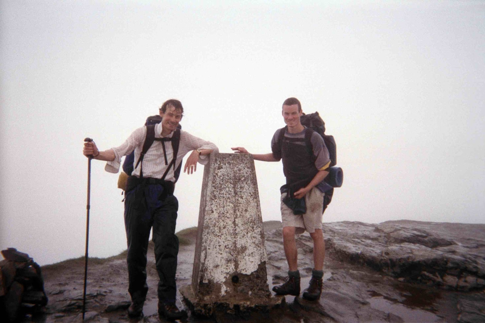
As the photo shows, we eventually arrived at the summit of Ben Lomond absolutely drenched. I'd not bothered with waterproofs because the final ascent was a stiff climb, and I didn't want to break my rhythm. The well-protected couple at the top, who took the photo, obviously thought we were barking mad.

The Watershed allowed us to follow the tourist route quite a long way down the south ridge towards Rowardennan, but eventually we had to bear left to avoid the streams.

We camped on boggy ground at 390993 near Elrig.

Wednesday, 30 June 1999

Day 42 - Stronachlachar and a rest day

Today's walk was along a fairly gentle ridge between the northwestern ends of Lochs Lomond to our right and Katrine (see photo) on our left. The highest point was Beinn a Choin (769m).

We descended through head-high bracken and an unidentified sweet-smelling white flowering plant to the little settlement of Stonachlachar, nestling between  Loch Katrine and Loch Arklet.

We camped at 402093 overlooking Loch Arklet.

That evening we hitched down to the Inversnaid Hotel for a meal, and were picked up by the first car, driven by the hotel owner! The following day we rested - taking the steamer SS Walter Scott from Stonachlachar to the Trossachs Pier. Tim then hired a bike and cycled down to Aberfoyle for some shopping. We walked back along the south side of Katrine, and were adopted by "Bruno" the labrador for several miles.

That evening we took the tent a little further along the Watershed to save ourselves a bit of  time tomorrow - and camped at 396075, to a good sunset.