About this blog

The journey from John o'Groats to Land's End took place in 14 sections, starting in 1996 (a week or so each year). The idea came to me in 1995 and I completed the British JoGLE Watershed in June 2009.

I was joined by a number of relations and friends from time to time. Most notable among my walking companions were my son Tim (7 sections) and nephews Peter and Jonny.

After walking the first section in 1996 I discovered that Dave Hewitt had already pioneered the Scottish Watershed (to Cape Wrath) in 1987, and had published his excellent account Walking the Watershed in 1994. We have been in touch since then, and he has been a great encouragement.

A simple definition of the watershed is that any rain falling to the left of the path finishes in the North Sea or English Channel, and anything to the right flows into the Atlantic Ocean, the Irish Sea or the Bristol Channel.

I believe that this was the first walk along the full length of the British JoGLE Watershed. I became aware just after I completed the journey that the late Mike Allen walked a slightly different version (from Land's End to Cape Wrath) between 1988 and 1994, so he will have covered the same ground apart from the most north-easterly 220km.

There have subsequently been several walks and publications about parts of the JoGLE watershed, including Peter Wright's 2010 Ribbon of Wildness account of his Scottish section walked in 2005, which has brought the subject of watershed walking in the UK to a wider audience.

I hope you enjoy this blog. I'm planning to publish a full account in 2013/4. A summary of the walk appeared in The Angry Corrie volume 76 in 2009.

Malcolm Wylie.

Wednesday 16 August 2006

Day 107 - Watershed confusion in Chard

It took us under 2 hours to get into Chard (the highest town in Somerset), from where we caught a bus into Taunton for the train home.

There were a couple of mini-dramas this morning. Peter lost his blood-sugar tester (just as well it was the last day, as this was important for him), and I found something like a tick on my eyelid. I was referred by the surgery to the hospital, but on my way there the thing fell off.

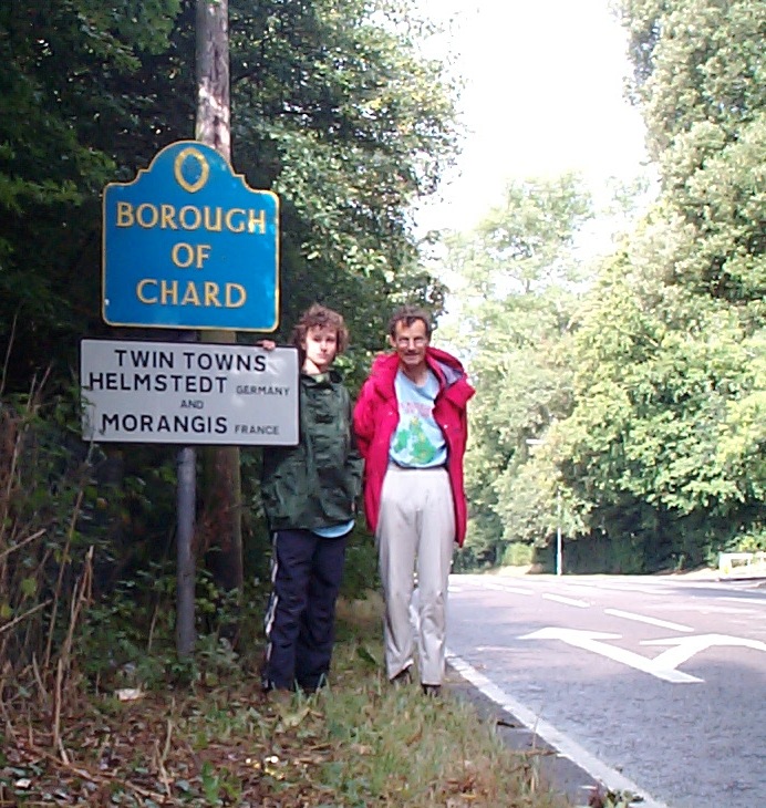
We discovered that Chard is one of the few towns which has water channels at the side of the streets. (Cambridge is another). Fore Street is reckoned to be exactly on the Watershed, with its little streams parting company to the north and the south. Tricky to spot on the map! [Chard is fascinating for several other reasons, which I'll describe in the book.] We left the Watershed at 322086.

The stats for Section 11 were 159km with 1,049m of ascent.

No comments:

Post a Comment